
קובץ:World 1910.jpg

גודל התצוגה המקדימה הזאת: 794 × 600 פיקסלים. רזולוציות אחרות: 318 × 240 פיקסלים | 635 × 480 פיקסלים | 1,017 × 768 פיקסלים | 1,280 × 967 פיקסלים | 2,124 × 1,605 פיקסלים.
לקובץ המקורי (2,124 × 1,605 פיקסלים, גודל הקובץ: 1.02 מ"ב, סוג MIME: image/jpeg)
תקציר
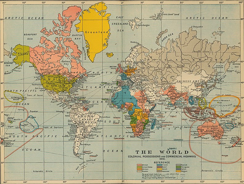
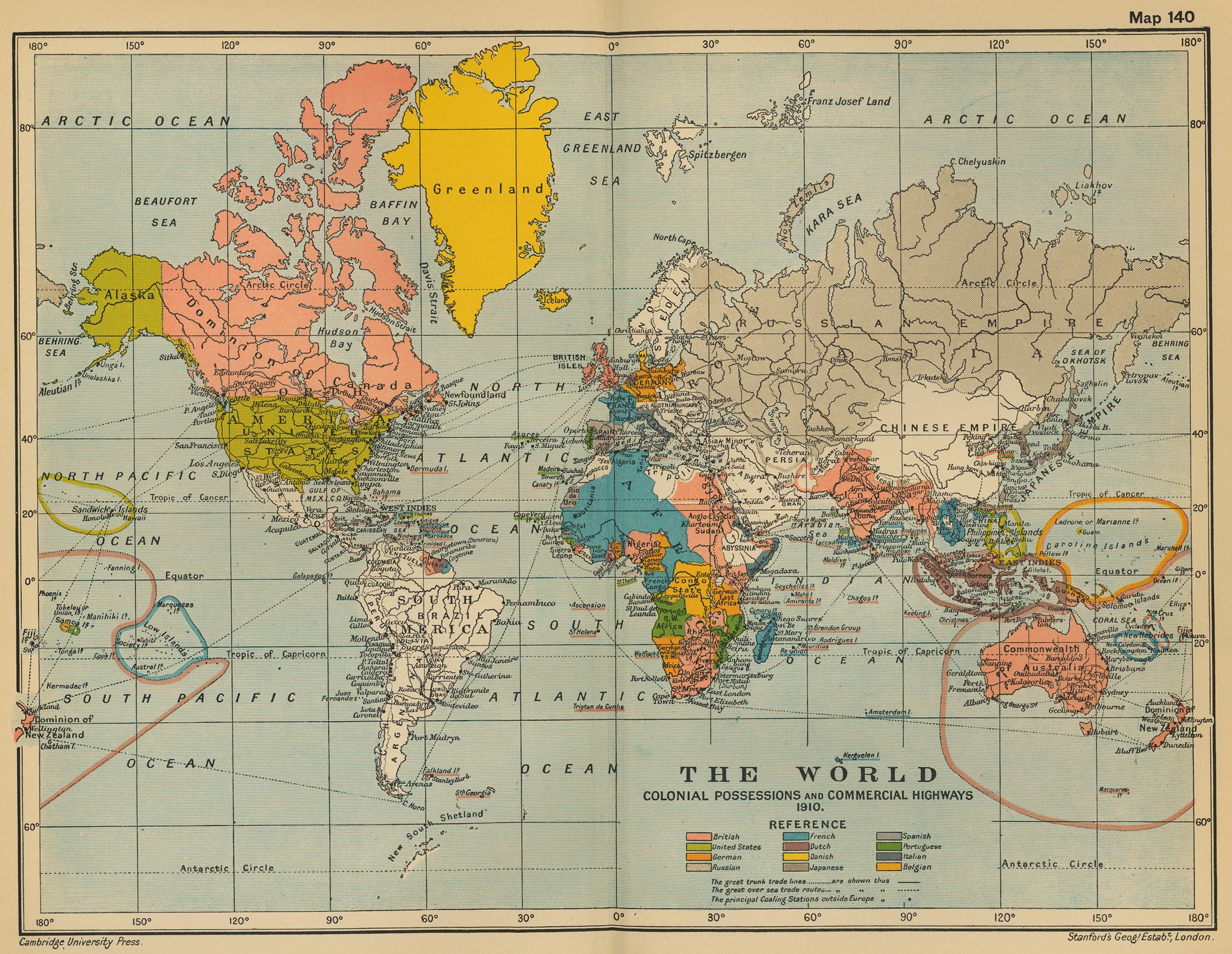
| תיאור | The World: Colonial Possesions and Commercial Highways, 1910 |
| תאריך יצירה | |
| מקור |
University of Texas Libraries, Perry-Castañeda Library Map Collection: Historical Maps, Cambridge Modern History Atlas, 1912 |
| יוצר | Edited by Sir Adolphus William Ward, G.W. Prothero, Sir Stanley Mordaunt Leathes, and E.A. Benians. |
רישיון
This work is in the public domain in the United States because it was published (or registered with the U.S. Copyright Office) before January 1, 1929.
Public domain works must be out of copyright in both the United States and in the source country of the work in order to be hosted on the Commons. If the work is not a U.S. work, the file must have an additional copyright tag indicating the copyright status in the source country.
Note: This tag should not be used for sound recordings. |
היסטוריית הקובץ
ניתן ללחוץ על תאריך/שעה כדי לראות את הקובץ כפי שנראה באותו זמן.
| תאריך/שעה | תמונה ממוזערת | ממדים | משתמש | הערה | |
|---|---|---|---|---|---|
| נוכחית | 19:16, 9 ביולי 2011 | | 1,605 × 2,124 (1.02 מ"ב) | Citypeek | turn and removal border |
| 05:31, 20 ביולי 2006 |  | 1,705 × 2,201 (971 ק"ב) | Roke~commonswiki | from [http://www.lib.utexas.edu/maps/historical/ward_1912/world_1910.jpg] Perry-Castañeda Library Map Collection Cambridge Modern History Atlas, 1912 Category: Old maps |
שימוש בקובץ
הדף הבא משתמש בקובץ הזה:
שימוש גלובלי בקובץ
אתרי הוויקי השונים הבאים משתמשים בקובץ זה:
- שימוש באתר ar.wikipedia.org
- שימוש באתר as.wikipedia.org
- שימוש באתר de.wikipedia.org
- שימוש באתר en.wikipedia.org
- שימוש באתר fa.wikipedia.org
- שימוש באתר fr.wikipedia.org
- שימוש באתר hi.wikipedia.org
- שימוש באתר hr.wikipedia.org
- שימוש באתר it.wikipedia.org
- שימוש באתר pl.wikipedia.org
- שימוש באתר pnb.wikipedia.org
- שימוש באתר ta.wikipedia.org
- שימוש באתר th.wikipedia.org
- שימוש באתר uk.wikipedia.org
- שימוש באתר ur.wikipedia.org
- שימוש באתר vi.wikipedia.org
- שימוש באתר zh.wikipedia.org